Aerial Whidbey
Informative aerial media. Media developed from aerial media.
3D geospatial modeling of shoreline and inland properties
Progressive 3D modeling to track property changes
360-degree aerial images for inspections
Aerial photos/videos, cinematography
Media about a Beach
Have the detailed imagery that you and your community need before calling Island County Planning, a geotechnical engineer, a plant restoration service, a land surveyor, or a construction contractor.
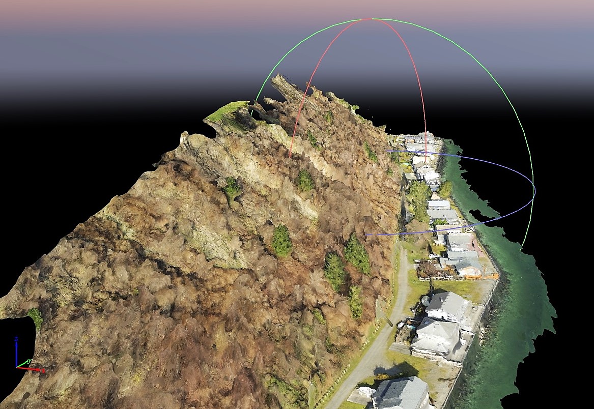
Some beach communities are already seeing increasing storm and high tide erosion that threatens their shoreline homes and vacation properties. There may also be worries about the state of adjacent bluffs and access roads.
Aerial Whidbey provides the recent and extremely detailed imagery that you and your community need before calling Island County Planning, a geotechnical engineer, a plant restoration service, a land surveyor, or a construction contractor. Be prepared for a discussion with neighbors or the rest of the community about potential next steps. Have a custom map - with measurement data - about the areas of concern.
Since every situation is different, reach out with the Contact form to start a conversation about what you have in mind, and the location of the property. Aerial Whidbey will suggest a range of possibilities and develop a quote tailored to your needs.